Sweet Creek Falls

Although Sweet Creek Falls is the ultimate prize, this 2.2 mile roundtrip out-and-back trail is a beautiful and easy hike along a creek that cascades and tumbles through a canyon in the Coast Range near Mapleton, Oregon. The hike stretches to 2.4 miles if you climb to the upper viewpoint of Sweet Creek Falls. This hike is a true gem, not to be missed.

| Clicking on the images or maps will bring up an enlarged image. |
Sweet Creek is named for Zarah Sweets, one of the Oregon Trail pioneers who settled in the area in 1879. In fact, there is a extension to this hike which incorporates part of an old pioneer wagon road.

The hike starts at the Homestead Trailhead which is reached from Sweet Creek Road. For much of the route, the trail hugs the creek coursing through an old growth forest of Douglas fir, moss covered rocks, ferns, creekside alder and big leaf maples. There is no definitive answer of how many waterfalls exist along the way (possibly as many as a dozen), but there seem to be four named ones.

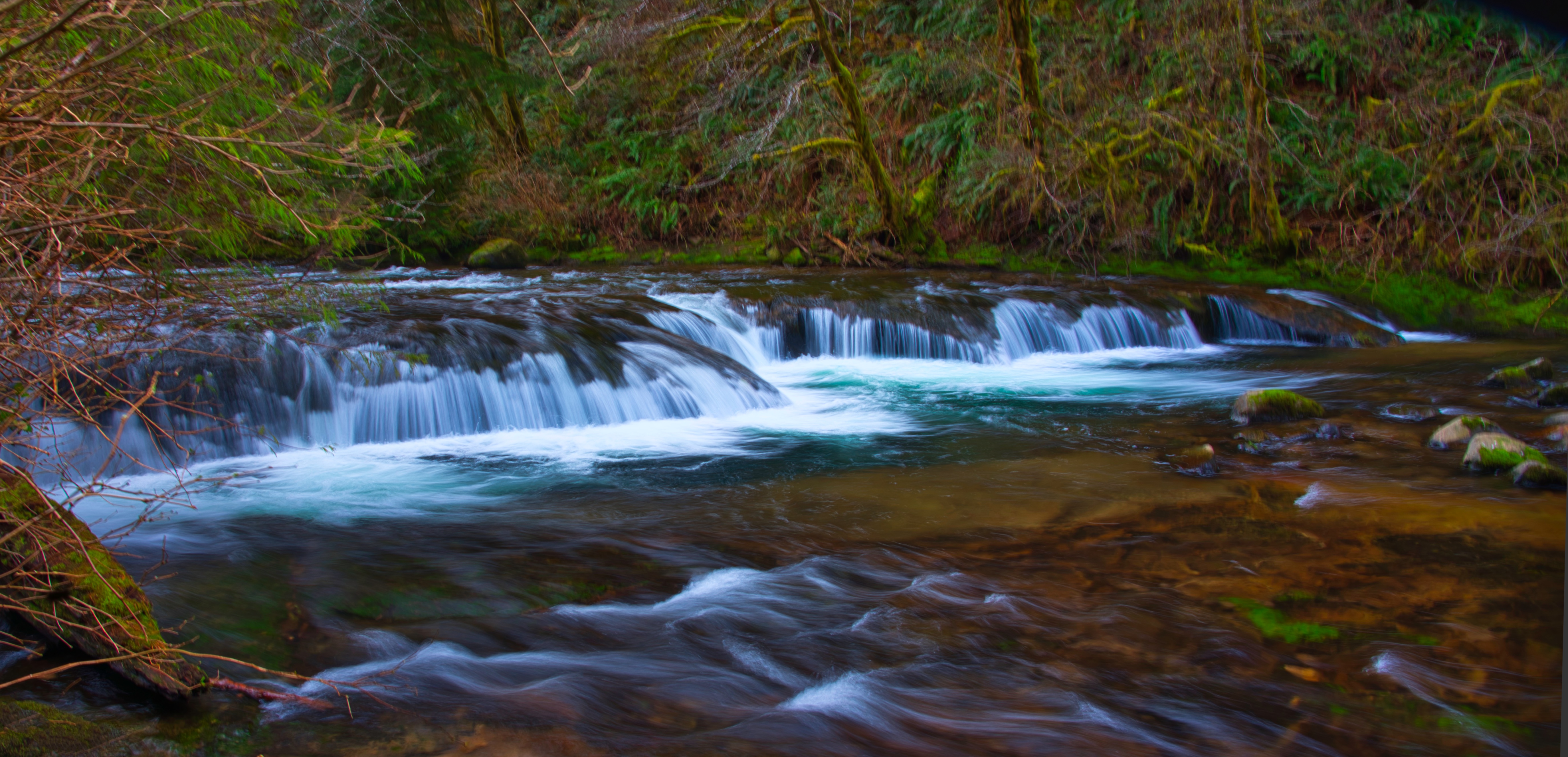
After a bit of hiking, the canyon narrows, and the trail traverses a set of catwalks bolted into the canyon wall. Punchbowl Canyon Falls is a series of pothole waterfalls in this canyon section. Here, the creek drops 35′ over a distance of about 150 feet with no single drop being more than 10′. From the trail, you can’t get a photo of this entire complex.

Just above Punchbowl Canyon, you see an obvious waterfall on the opposite side of the creek where Earl Creek drops a total of 35′ into Sweet Creek. This is Annice Falls which is in the background in this photo with the top of Punchbowl Canyon Falls in the foreground.
At about half a mile from the trailhead, Sweet Creek tumbles over Ledge Fall with the water cascading over angled ledges.
At 0.7 miles, a path joins the trail from the left. This path comes from another trailhead along Sweet Creek Road called the Sweet Creek Falls Trailhead. At this point, you are about 0.4 miles from Sweet Creek Falls. If you only want to see the falls without taking the longer hike, you can get there from this closer trailhead but would miss a lot of the flavor of the area.

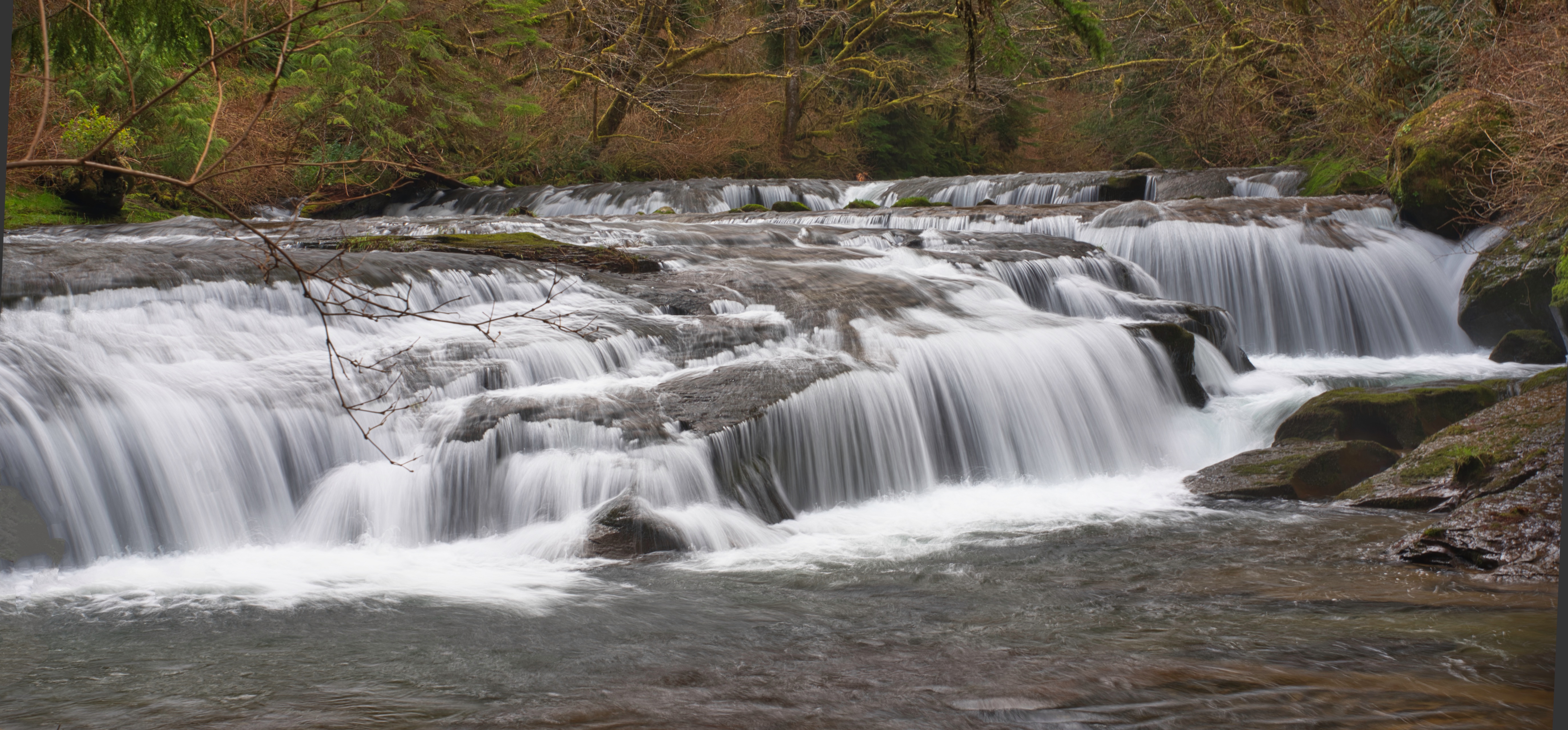
Sweet Creek Falls drops 70 feet in four tiers. From the main trail, you can only see the third and fourth tiers which each drop 15′ into a large pool (photo left). The first (top) tier is a 10′ punchbowl fall that can only be seen from the trail above the falls. The second tier is a 30′ horsetail fall that drops into a narrow crack in the cliff and can be seen from the upper viewpoint. There is nowhere on the trail to see the entire waterfall at one time.
If you wish to extend your hike, you can wade across the creek below Sweet Creek Falls, continue on the trail to the Wagon Trailhead, and then follow a 0.6 mile trail to Beaver Creek Falls. In winter, it is not possible to safely cross the creek to add the extension. Instead, you must return to the Homestead Trailhead where you started your hike and drive 1.3 miles on Sweet Creek Road to the Wagon Trailhead.
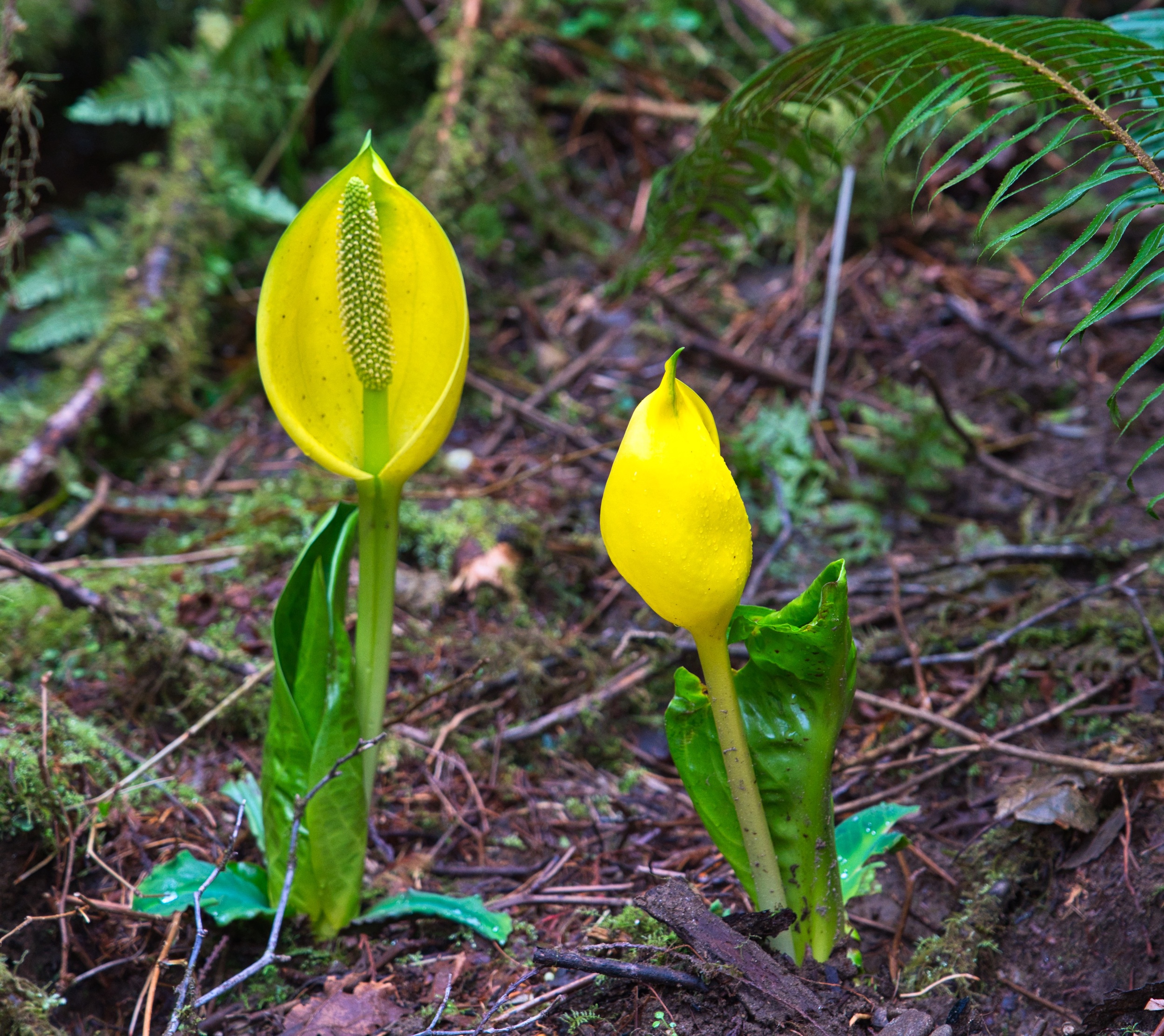
On my hike during the first week of March, I saw a some harbingers of spring such as flowering skunk cabbage (right) and the first flowers of the wild rose (below).

Later in spring, you should find a beautiful trillium display as well as a greater proliferation of wild roses. Fall is also an excellent time to hike this trail with the red of the maple leaves combining with the velvet greens of the mosses and ferns.
| To reach the Sweet Creek Trail, turn onto Sweet Creek Road at the east end of the Siuslaw River bridge on OR-126 at Mapleton. Drive 10.2 miles to the Homestead Trailhead or continue an additional 1.3 miles to the Sweet Creek Falls Trailhead. |