Late June through July is the prime wildflower season in the high meadows of the Oregon Cascades. I decided to hike the Echo Basin Trail in the Willamette National Forest on a wildflower quest. This trail is located between the Santiam and Tombstone Passes in the “Old Cascades”, a geological region of mountains that are older and lower in altitude than the more notable volcanic peaks of the “High Cascades” such as the three Sisters and Mt. Jefferson. The trail leads to a wet, high meadow on Echo Mountain. For my hiking efforts, I was rewarded with many wildflowers blooming, and the bonus of a healthy supply of moths, butterflies, dragonflies, and other insects that were feeding on nectar and drinking in patches of mud.

The Echo Basin Trail is a moderate 2.4-mile roundtrip, lollypop-shaped hike (out to a loop and back) with about a 600-foot elevation gain. Almost all of the elevation gain is in the first 0.7 miles where the trail is steep (average 12% grade, maximum 27%) and at times a bit rocky.
There is a signboard at the trailhead and parking along the road for a few vehicles. This is a lightly used trail. Hiking during mid-week, I encountered only five other people split into a couple of groups over the four hours I spent in the area. The hike itself can be completed in about 1-1.5 hours, but I spent a lot of time photographing flowers and insects!

The Trail


Starting off, the trail climbs steadily through young fir trees. Not far from the trailhead, you encounter a pair of abandoned logging cables on the trail as it traverses a stand of secondary growth that has overgrown the old logging road. The cables are remnants of the logging which harvested the old growth trees in the 1980s. Along the way, there were patches of white Trillium blooming, and where the sun reaches the understory, Western Columbines added red accents.
After about 0.3 miles, the trail enters an old-growth stand of Alaska Yellow Cedar trees which are rare in Oregon and seldom found south of Mt. Jefferson. The trees of this stand, the largest of their kind in Oregon, are easily distinguished by their shaggy silver bark.


About half a mile from the trailhead, the trail reaches a bridge over Echo Creek. This is the point at which the loop section begins. You can take the loop either clockwise or counter-clockwise. I chose counter-clockwise and would recommend that direction for ease of following the trail.

After a short walk traveling in the counter-clockwise direction (to the right), the trail exits the forest into a densely vegetated, horseshoe-shaped meadow amphitheater etched from Echo Mountain.

In contrast to the trail through the forest, here, it passes through lush vegetation that is sometimes shoulder to head high.

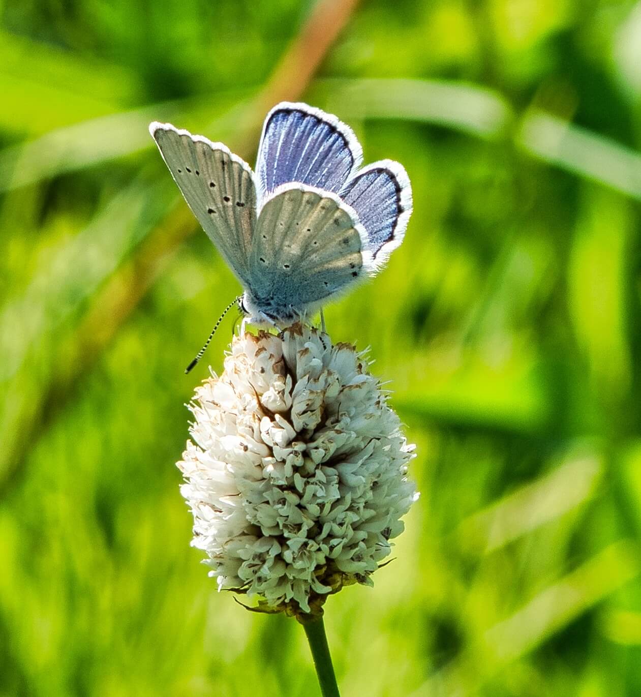
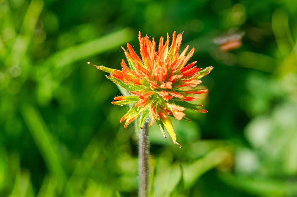
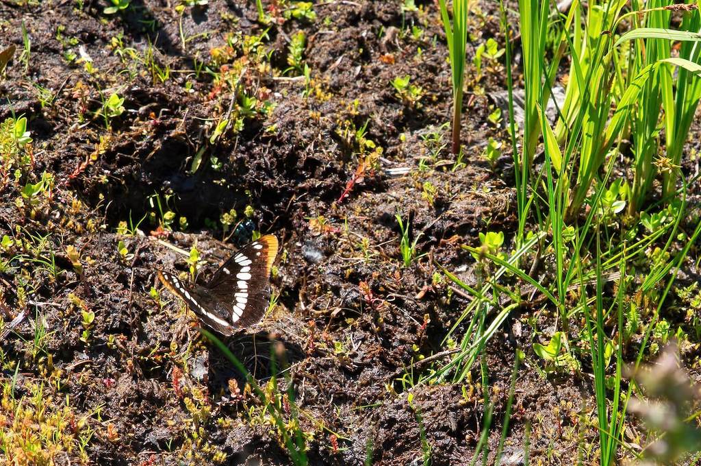
Continuing around the basin, the meadow becomes boggy due to the numerous small springs that eventually form the headwaters of Echo Creek. Although there are a number of boardwalks for traversing the water and mud, expect to get wet, muddy feet on the non-boardwalk sections of the trail. A variety of flower species as well as bees, butterflies, dragonflies, damselflies, moths and some biting horseflies inhabit the meadow. Butterflies can often be observed drinking in the mud patches. Surprisingly, no mosquitoes were in evidence.
Here are some examples of the flora and fauna found in the meadow:


As you proceed through the meadow, the trail becomes more and more overgrown. Before attempting this hike, I read one review indicating that the reviewer’s 4-year old child had no problem completing the trail. I doubt this child was able to walk this section of the trail as it was mostly obscured by head-high Devil’s Club.

For those unfamiliar with Devil’s Club, it is a plant found primarily in the Pacific Northwest and Alaska. All exposed surfaces of the plant are covered with spines except the roots and berries. Even the huge leaves are armed with spines. This is a plant that you do not want coming into contact with your skin!
As the trail re-enters the trees to complete the loop, it becomes very difficult to follow. I eventually turned around, hiked back across the meadow and returned to the trailhead the way I had come.
HIking Tips:
- Wearing long pants due to the presence of large amounts of Devil’s Club is recommended
- Sturdy hiking shoes (waterproof if you do not want wet feet) are recommended
- Care should be taken on the boardwalks as a some planks are no longer securely fastened
- Stay on the trail in the meadow as much as possible. This is a very fragile environment
- Dogs are permitted on leash, however, this is not the best hike for your canine companion
- Cellular service is very limited so do not rely on a phone for emergencies

This hike pairs well with the Hackleman Old Growth Trail for a nice day trip. The Hackleman Old Growth Trail is made up of two loops that wind through a forest of huge old growth Douglas-Fir, Western Red Cedar, and Western Hemlock trees with some being 500 years old. One of the loops incorporates a section of the Old Santiam Wagon Road. This trailhead is about 0.5 miles from the turn-off for the Echo Basin Trail and starts from a parking lot right off the highway.
| Travel Directions to Echo Basin From Sweet Home: Take US-20 east for about 37 miles to the turn-off onto Forest Service Road 055 (“Echo Basin Road”). This is a gravel road on the left with a sign for the Echo Basin Trail. There is no advanced warning of the turn-off, but it will be about 0.5 miles beyond the Hackleman Old Growth Trail which is well signed. Drive about 2 miles on Echo Basin Road. The trailhead is on the right just after the road curves sharply to the left and widens for parking. From Sisters: Take US-20 west. After Santiam Pass, US-20 branches to the left. The road continuing straight ahead is OR-22 going to Salem. Turn left at this Y-intersection to continue on US-20 west. Drive 8.6 miles from the intersection to Forest Service Road 055 (“Echo Basin Road”). This is a gravel road on the right with a sign for the Echo Basin Trail. There is no advanced warning of the turn-off, but it is just beyond a sign for the upcoming Hackleman Old Growth Trail. Drive about 2 miles on Echo Basin Road. The trailhead is on the right just after the road curves sharply to the left and widens for parking. Notes about Echo Basin Road: This road is rough and rocky in spots, sometimes narrow, and, just before the trailhead, is deeply rutted. A high clearance 4-WD vehicle is not required, but a very low clearance vehicle is not recommended. My small SUV had no problems navigating the road. |